ORIENTATION AND NAVIGATION SYSTEMS

As part of recent rebranding for the town, Streetwise completed a refresh of Reading Explorer’s graphics to adopt the essence of the new Reading Borough Council branding; the base colour of the graphics and the unit caps were changed to reflect this. Two new units have been installed, an additional unit to the north of the Forbury district and one to the north of the Thames district.
In addition there are plans to expand the system to new districts of the town, including a further new unit once the expansion of Reading Station is complete in 2013.
The pedestrian navigation system is based upon three levels of mapping. The second side of each unit features interpretation of Reading’s notable buildings as well as events, industries and people that have helped shape the town.
The 21 information points encourage visitors to explore throughout the town; each of the units also promotes an attraction in another part of Reading.
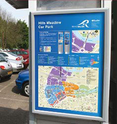
Visitors to the town are assisted on arrival by information panels prominently displayed in all car parks serving the town centre.
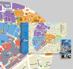
The on-street units are complemented by information panels displayed on 30 bus shelters throughout the town centre. Each of these panels displays a large scale town centre map.
The Reading pocket map is distributed widely throughout the town. The map of the town centre is complemented with a flavour of the town’s history and explanation of the Reading Explorer system.